
1048 Data visualizations Categorized "my city in data" (page 53 of 53)


The method of transport I have used during my life and what I expect in the future

Annual average snow days in cities I have lived in. Data is from Weather Atlas, which uses different aggregated country resources that can be seen here (open data…
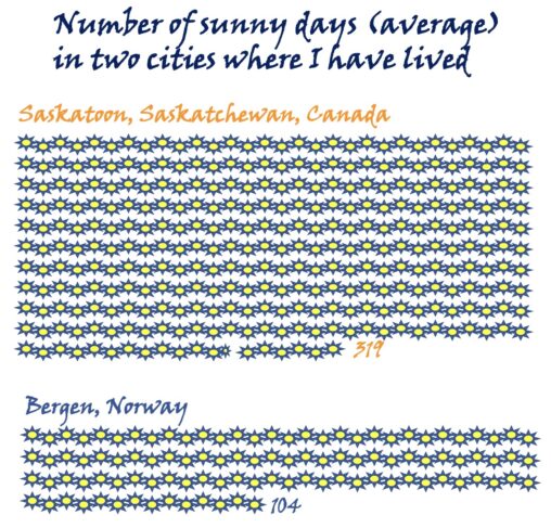
Average number of days that are considered sunny (Saskatoon data from 1981 – 2020 ; Bergen 2009 – 2022)

This data visualization shows the number of hats that were collected, each month in 2020, by Seville’s City Council.
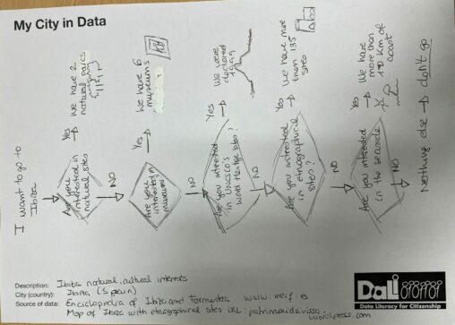
It is a flowchart to show some data about natural, historical and cultural sites of Ibiza.
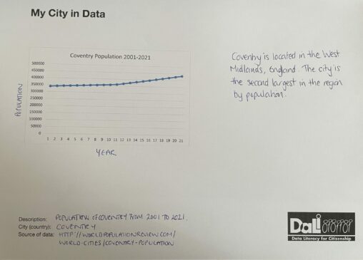
The city of Coventry covers a total surface area of approximately 98.6 square kilometers. With a population creeping upwards to 432,000 and beyond, the density of the residents…

Average rainfall (mm) in Coventry (UK) between 1999 and 2020. Data available from the Met Office (UK Government) under Crown Copyright.